
trail of fire
the problem presented:
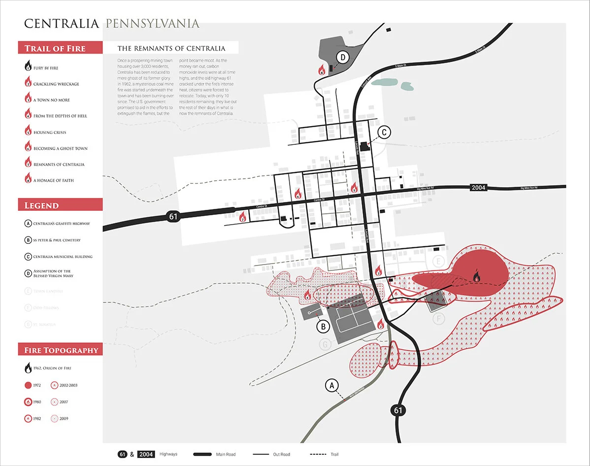
For my Interactive Design class, we were asked to find a place to create or recreate a unique form of map design, regardless of if the place is real or fiction. In my research, I found the now government-owned town of Centralia, Pennsylvania, rich with a tragic history that became buried in the past. I took this opportunity to attempt to tell its story through this assignment.
my solutions:
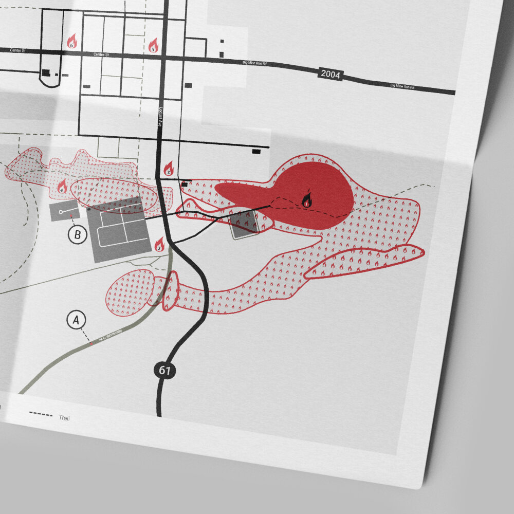
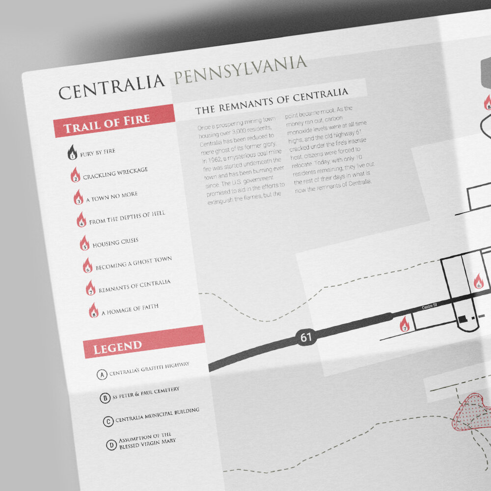
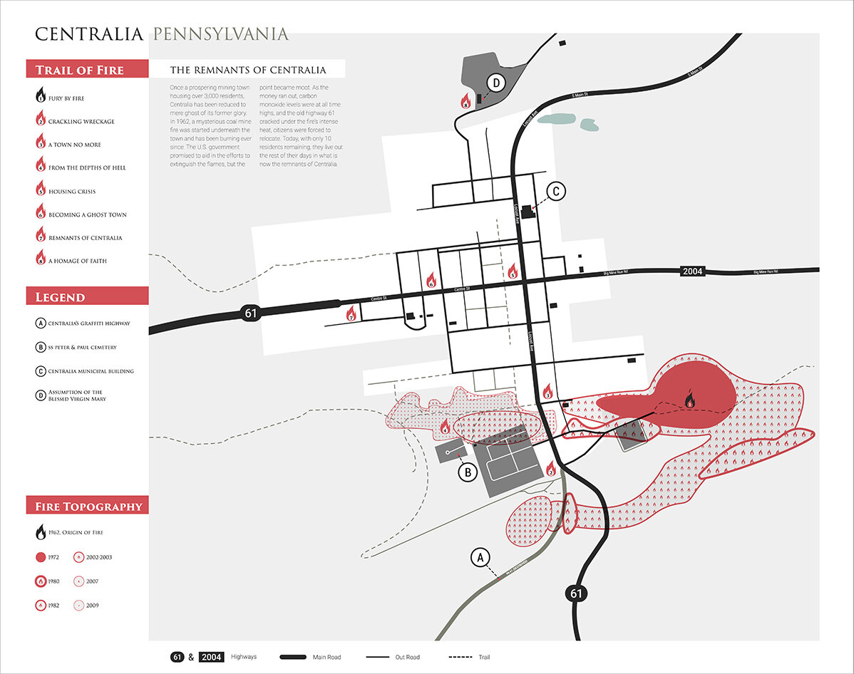
Centralia, once prosperous in the 1960s, was reduced to a population of less than 10 people due to coal mine fires burning underneath what once was to this day. Aptly named as the Trail of Fire, I used the research of Centralia’s history and wanted the map to have an interactive element to it. I wanted to reflect this through a topographic solution of the fire’s spread throughout the decades. There are also two versions of this map: one where it’s current day Centralia, and a Centralia from 1962 revealed by light. The revealed map shows the faded remains of the many buildings that once resided as well as previous roads and trails that no longer exist. Needing light to show the long-lost prosperity of the coal town is meant to represent how much the fires have consumed.
To create a sense of an educational tourist attraction, the Trail of Fire on the map points to tempered glass signage placed in various places throughout the town. Each are numbered as the path to walk and learn about Centralia’s success and inevitable downfall. The images represented on each one are of the actual town before the fires, meant match up with the scenery. This is to give those who walk the tour a glimpse of what the town once was in the surrounding of present day, with arrowed markers to help people know where to stand.

more work